These 23 Midwestern Counties May See a Spike in COVID-19. Here’s Why.
Check out the latest analysis from The Covid Alliance, who tracked the potential spread of COVID-19 from the 2020 Bikefest in Missouri using X-Mode’s data.
By Joseph Green
X-Mode is excited to announce yet another collaboration with The Covid Alliance, who have been using X-Mode’s aggregated location panel to tell the story of the coronavirus pandemic as well as to develop tools for a more intelligent response.
We have previously worked with The Covid Alliance on a number of pandemic-related research projects; this time, the insights we have presented are even more urgent. After performing geolocation analysis on the recent BikeFest event in Missouri, The Covid Alliance has determined a list of 23 Midwestern Counties at elevated risk of a COVID-19 spike. Read on for more details on the impact of this latest “superspreader” event, and to learn what steps those in at-risk areas can take.
Bikefest 2020: A Superspreader Event?
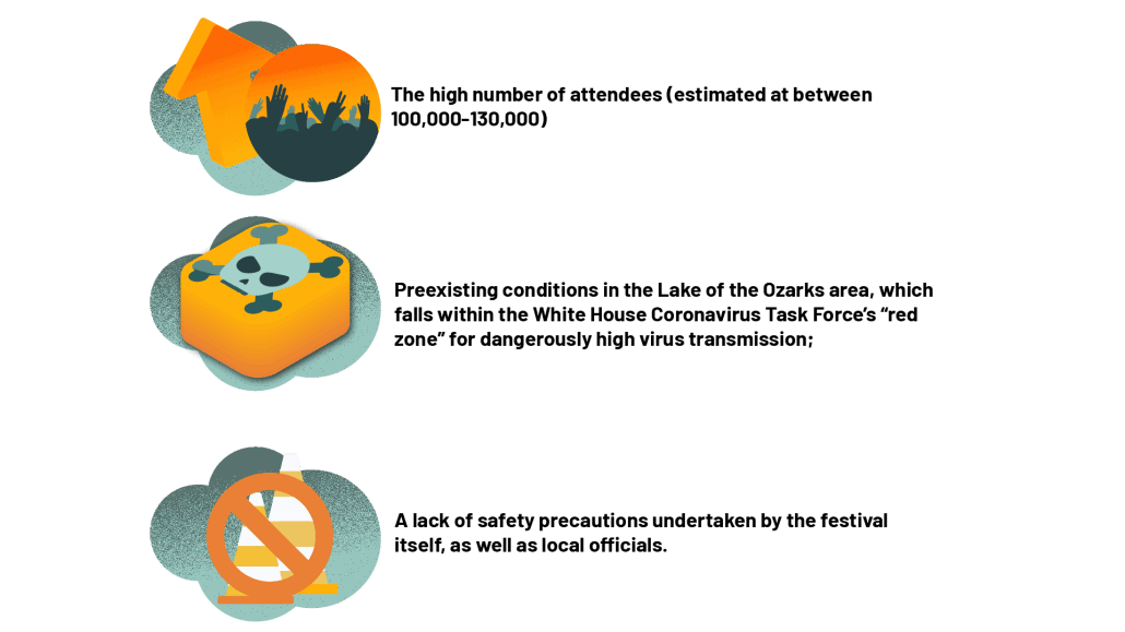
The Covid Alliance’s analysis looked at mobile location data from the 2020 Lake of the Ozarks BikeFest, which took place in Missouri in mid-September. Similar to the recent Sturgis rally in South Dakota, the BikeFest has been identified by The Covid Alliance as a potential superspreader for COVID-19. This is due to several factors surrounding the event:
To further emphasize this last point, I would like to quote The Covid Alliance at length:
“In defiance of White House guidance to close bars and dining, an official BikeFest “passport” program encouraged the estimated 100,000 attendees to visit more than 300 bars, restaurants, live music and entertainment shows, many of which were indoors and at full capacity throughout the weekend. Unlike nearby urban areas such as Kansas City and St. Louis, few areas around the lake have required face coverings — and none had put in place limits on mass gatherings. On-the-ground reports suggest only a handful of visitors were seen wearing masks.”
What Happens Next?
Crucially, the increased risk of infection is not limited just to the BikeFest itself. As analysis of the Sturgis Bike Rally and other superspreader events has shown, attendees of the event carry the virus with them when they return home. This means that localized events can have a far-reaching — and potentially catastrophic — impact. To quote Joseph Sabia, director of the Center for Health Economics and Policy Studies at San Diego State University, “Third parties who didn’t choose to go to [ Sturgis] are now paying some of the price for a rally they did not attend.”
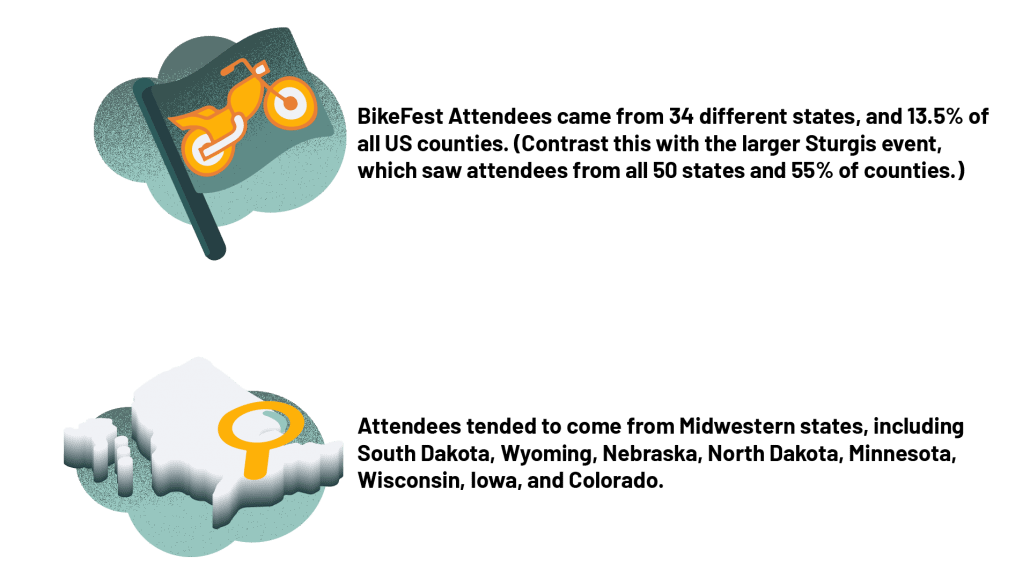
So how do we track the spread of infection in the days and weeks after the event? That is where The Covid Alliance comes in. By leveraging X-Mode’s location panel, the team was able to determine which states and counties are at the highest risk of a COVID spike following the BikeFest.
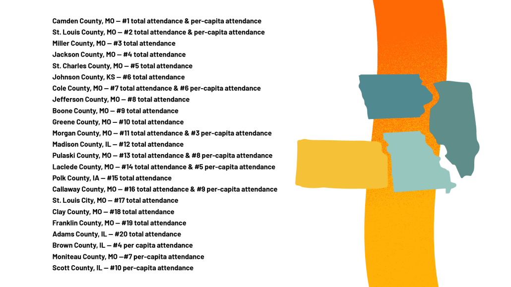
Taking into account this information, as well as the previously-mentioned risks present at the rally, The Covid Alliance provided notifications to local public health departments in the following 23 counties as a result of returning BikeFest attendees:
So What?
X-Mode and The Covid Alliance have neither the authority nor the ability to dictate public safety measures. What we do have, however, is a vast wealth of high quality location data, and the tools to draw valuable insights from it. In the past, these resources have often been locked behind garden walls, sold mostly to marketers and advertisers. In addition, even those pro-social organizations that do gain access to location data often have neither the experience nor the resources to leverage it effectively.
The work done by The Covid Alliance demonstrates an alternative way to think about geolocation-based analyses. Location data is not a commodity to be profited off of; it is a valuable shared resource with a unique power to improve communities and save lives. This is the underlying ambition of Picket, X-Mode’s Data for Social Impact initiative. With the help of The Covid Alliance, that ambition is being realized.
Using the technology they developed on top of X-Mode’s data, The Covid Alliance was able to create their list of at-risk counties within less than 36 hours. Imagine the possibilities offered by this kind of rapid response. Cities could optimize evacuation routes in real time during a natural disaster. Major disparities in wait times at polling locations could be picked up on a systemic level. Cities and towns, with the help of ethically sourced location data, can become smarter, safer, and more responsive to the needs of the public. The benefits offered by this kind of data staggers the imagination; but only if the tools are built right.
Since our company’s early days building safety apps, we have known that the high quality of our data presents unique opportunities for social good. With the launch of Picket in 2018, we began to pursue partnerships with researchers and nonprofits interested in developing those kinds of prosocial solutions. Too often, though, we have run into bottlenecks making the data accessible to organizations with insufficient experience or resources.
With the platform developed by The Covid Alliance, those bottlenecks are all but eliminated. High quality aggregated location data, and the tools to effectively leverage it, are more accessible than ever to those who would use them for good. Tracking the spread of COVID-19 is a vital use case at this time, but it is also only the beginning. We believe this is the start of a bright new future, one that we are excited to enter side by side with The Covid Alliance.
X-Mode partnered with The Covid Alliance as a part of our Data for Social Impact initiative, Picket. This is only the latest strategic partnership undertaken by Picket during the COVID-19 crisis — we have also worked with researchers at UVA, Sickweather, and other groups leveraging location data to combat the virus. Head over to our Picket page today to learn more about this initiative — and subscribe to our newsletter for more updates on how we are using location data to change the world.


